For navigation during your self-guided bike tour in Denmark you can use maps with optional cue sheets or a GPS (Global Position System) device, or both. When you book a tour through one of the bike tour companies they will provide you with daily routes. Cycling self-supported means that you must organise this yourself.
Cycling routes in Denmark
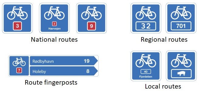
Denmark has a wide and extensive network of cycle routes throughout the country. It is a structured system of well-marked long distance national routes, regional cycle routes and local cycle routes. This route network connects to (and is part of) other European routes.
-
Also check traffic signs and road signs in Denmark.
Danish cycling maps
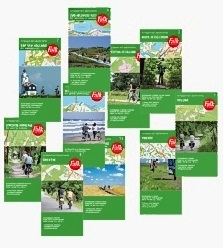 Good cycling maps help you to find your way around, and to avoid roads with heavy traffic when cycling in Denmark. The recommended scale for cycling maps is between 1:50,000 and 1:100,000. For an overview of your route you can use a 1:200,000 or 1:400,000 Michelin map. Many maps use a green line along roads to indicate that it's a scenic route. There are also maps and atlases that give day roundtrips, as well as long-distance (LF) routes.The cheapest way of getting maps, is to buy them on arrival in Denmark. But some (more detailed) cycling maps might be hard to find in the local tourist information offices or book shops. If you want to be sure about having the maps, and you don't want to miss out on the fun of using the maps to plan your trip weeks before you start your tour, it's also possible to buy Danish maps online or even in your own country.

-
Detailed maps only cover small areas and if you are doing a longer tour you will find yourself having to buy a lot of them, which is rather expensive and also quite heavy. A good compromise in this case is to buy a road atlas, tear out the necessary pages and only take those. You can also highlight the route (and alternative routes) with a marker pen. For both options you can carry the map sheets in a map-holder or a transparent handlebar bag cover, which is much easier than dealing with a folded map.
-
Use route or cue sheets (with turning point instructions) only in addition to maps; without a map you can easily get lost or disorientated at some point and a good map provides you with far more references than a route itinerary.
GPS
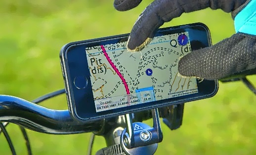 Currently there are many GPS (Global Position System) navigation products available on the market, including hand-held GPS devices, right through to online routing programs at which you can choose existing cycling routes or create routes yourself and download these to your GPS device, for free or paid.
The ‘pros & cons’ in using GPS during your cycling tour.
PROS
-
GPS shows you where you are at all times, with a zoom-in on the screen map;
-
The route can be pre-programmed, and the GPS device will do the navigation for you;
-
GPS gives you an accurate calculation of your speed, distance travelled etc.;
-
You can add your own ‘way marks’ and points of interest to the programmed route;
-
You can record your tour data of routes and distances for later presentation and analysis;
CONS
-
Navigating with a paper map is mentally challenging - using GPS takes all the fun out of it;
-
Route planning is a lot easier on a paper map than on a GPS because of the small screen;
-
For a single tour a GPS (plus electronic map) device is more expensive than a set of paper maps;
-
Maps don’t break and run out of batteries.
There are some GPS functions that are not yet fully evaluated to support cycling. Take this into account when you intend to purchase a GPS device.
- Not all electronic maps show cycle paths and lanes;
- Not all GPS devices are waterproof;
- Not all electronic maps are routable for cyclists (following the roads like in a car system).